|
 -
General Description -
General Description
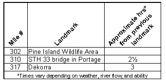
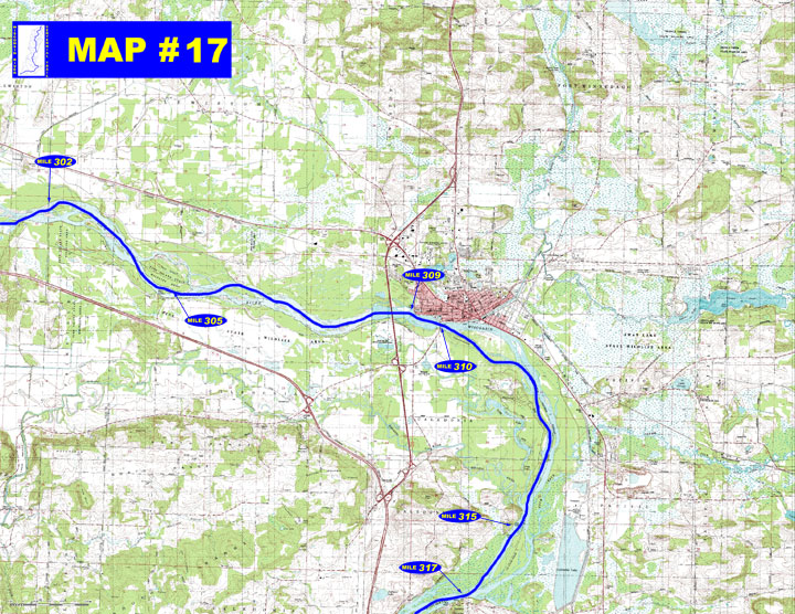
o Miles 302 - 310 (Pine Island Wildlife Area to Portage) River continues
east through the Pine Island Wildlife Area to the city of Portage.
o Miles 310 - 317 (Portage to Dekorra) Many small tributaries enter
the river behind islands forming many side channels. The Baraboo
River, a major tributary enters from the west just upstream from
Lib Cross Island.
- Portages - No portages on this stretch of river
- Landings suitable for take-out or put-in
o Mile 305 Pine Island boat landing (right)
o Mile 309 Sunset Park boat landing (left)
o Mile 315 Waterfront Rd. and Thunderbird Dr. boat accesses (right)
o Mile 317 Dekorra boat landing (left)
- Camping
o No known campgrounds on this stretch of river.
- Other amenities
o Mile 309 through Mile 311 - Many businesses in the City
of Portage & Surrounding
area.
o Mile 317 - Dekorra Park with picnic area and restrooms (left)
- Flow Information - “For information on river flow near Portage on this website go to Flow Forecasts under Wisconsin River /content.cfm?PageID=84&Cat=0)”.
|


 -
General Description