|
 -
General Description -
General Description
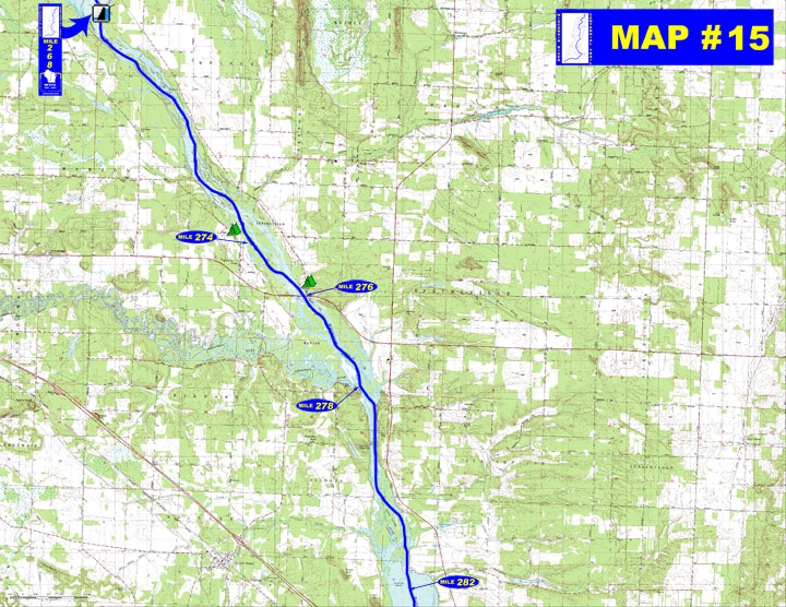
o Miles 268 - 276 (Castle Rock dam to STH 82 bridge) The river flows
south past Castle Rock with numerous side channels and sloughs containing
many islands and sandbars
o Miles 276 - 278 (STH 82 bridge to Lemonweir River) Lemonweir River
flows in on the right with the south shore bordered by high sandstone
cliffs
o Miles 278 - 282 (Lemonweir River to Upper Dells) River is narrow
and deep as it passes between high bluffs and unique rock formations
until Clarke Island where several tributaries enter forming side
channels, sandbars and willow islands
- Portages (see portage maps by clicking on the dam symbol)
o Mile 268 Castle Rock dam - Take-out at a cement ramp and follow
the route for about a ? mile long portage to the put-in just at
the mouth of the Castle Rock ditch that parallels the east dike
(left)
- Landings suitable for take-out or put-in
o Mile 268 Wisconsin River Power Company WRPCO boat landing below
Castle Rock dam (left)
o Mile 278 Two Rivers boat landing where the Lemonweir River enters
the Wisconsin (right)
o For a Wisconsin River Power Company informational map of Castle Rock Flowage showing additional access sites go to http://www.wisconsinriverpower.com/recreation_castlerock.pdf)
- Camping
o Mile 274 Private campground - "Castle Rock Resort & Campground
(608-847-6269)"
o Mile 276 Private campground - "Point
Bluff Resort (608-253-6181)" with canoe and kayak rentals
and shuttle service
- Other amenities
o Mile 268 - WRPCO Castle Rock dam recreation area with boat landing,
picnic area, restrooms, boater concessions, and trail (left)
- Flow Information - For flow information on river flow below Castle Rock go to http://www.wisconsinpublicservice.com/environment/hydrodata.aspx.
|